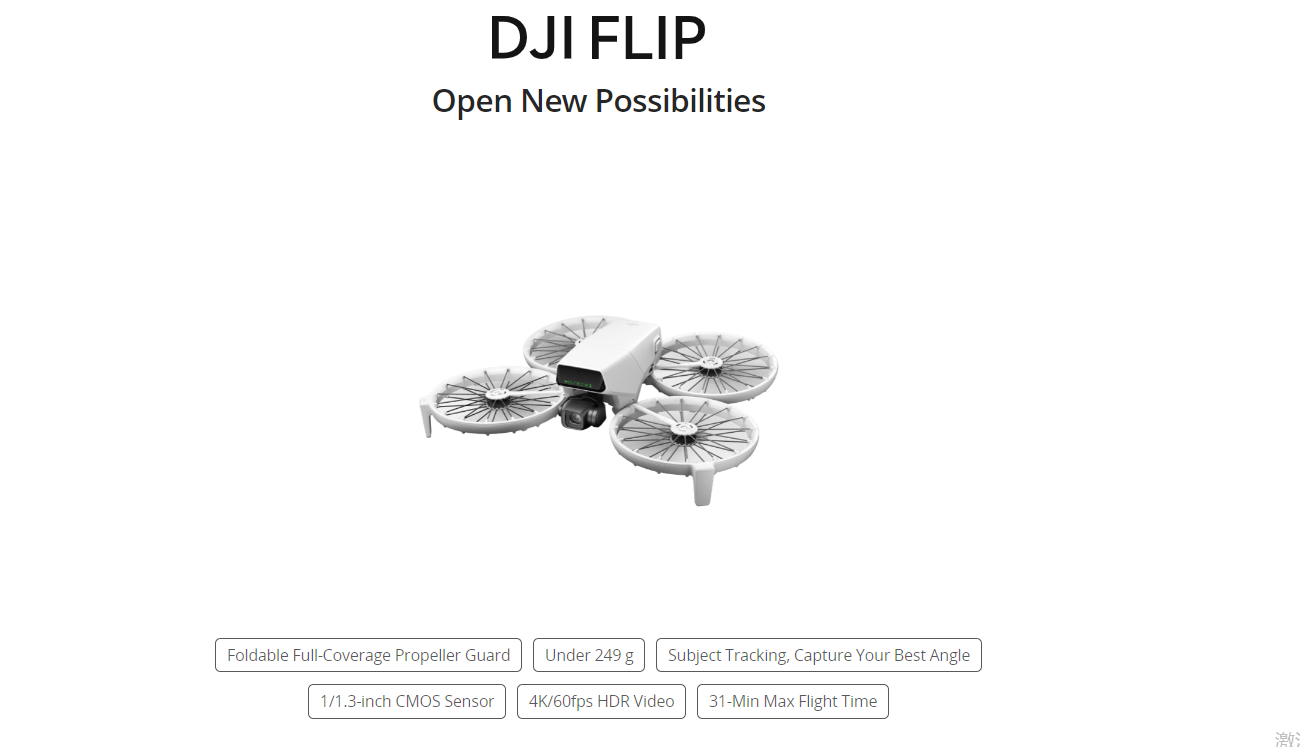
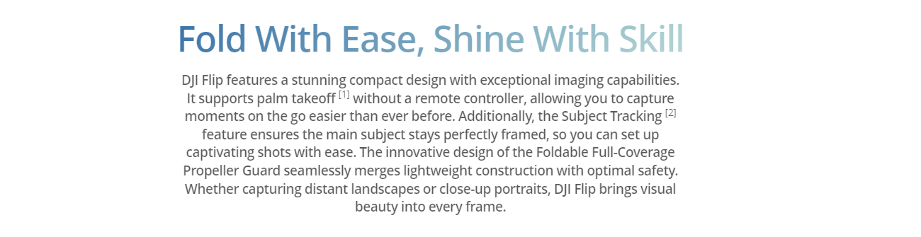
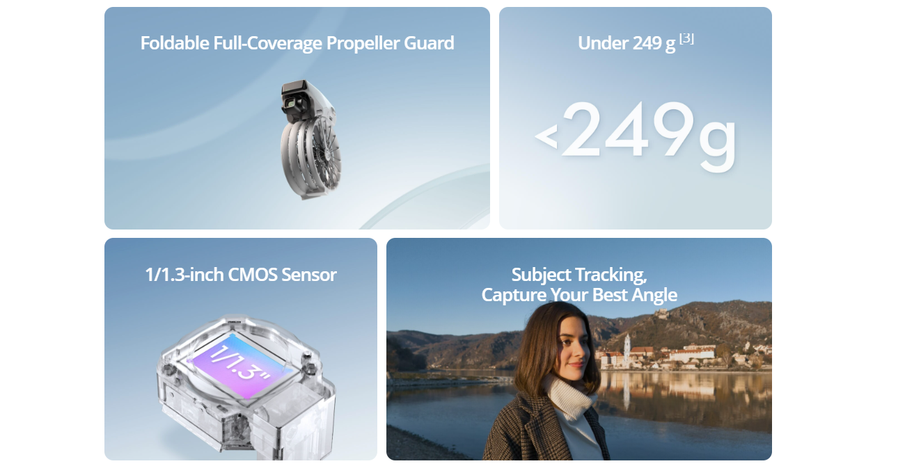
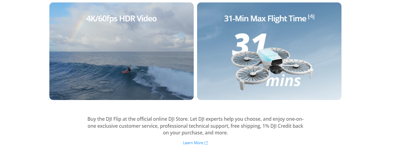
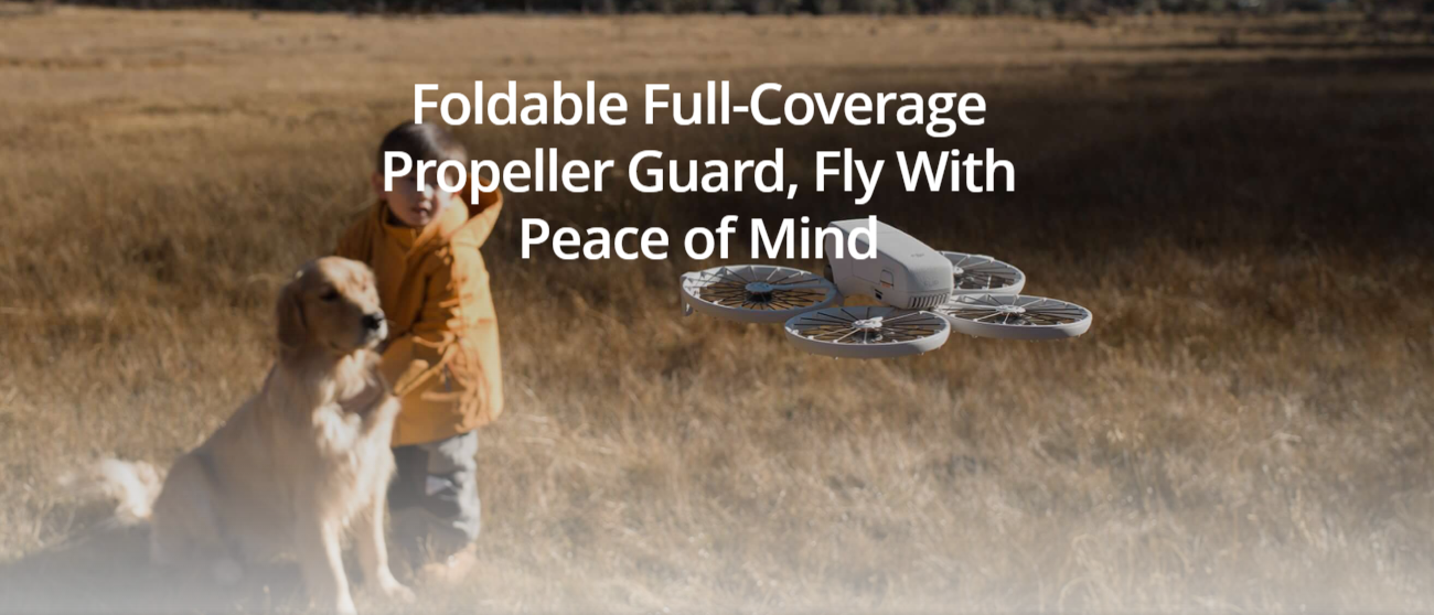
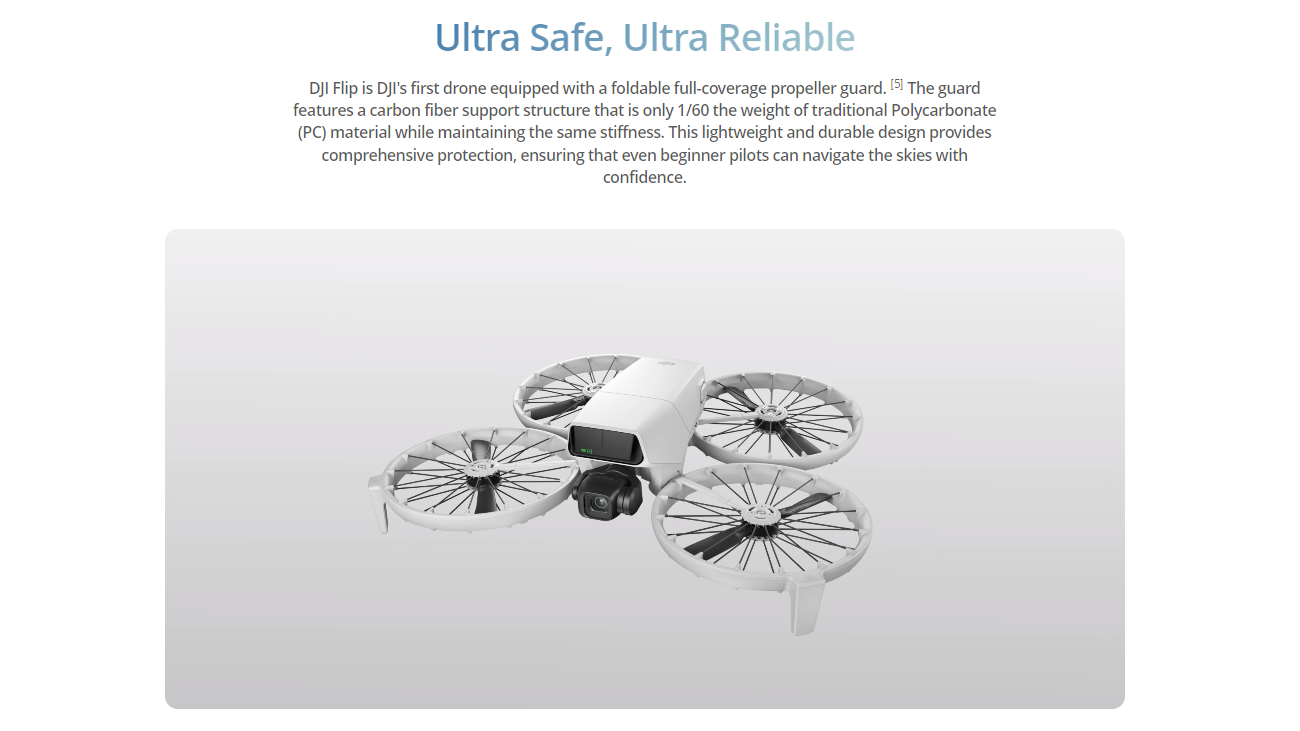
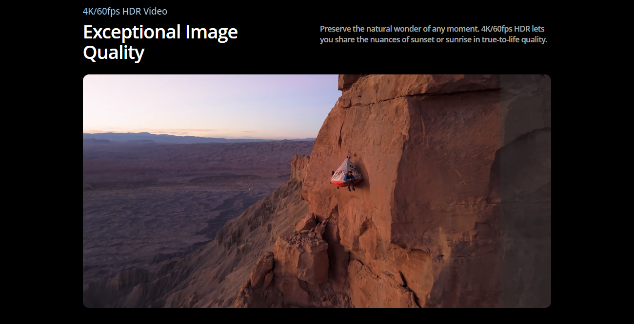
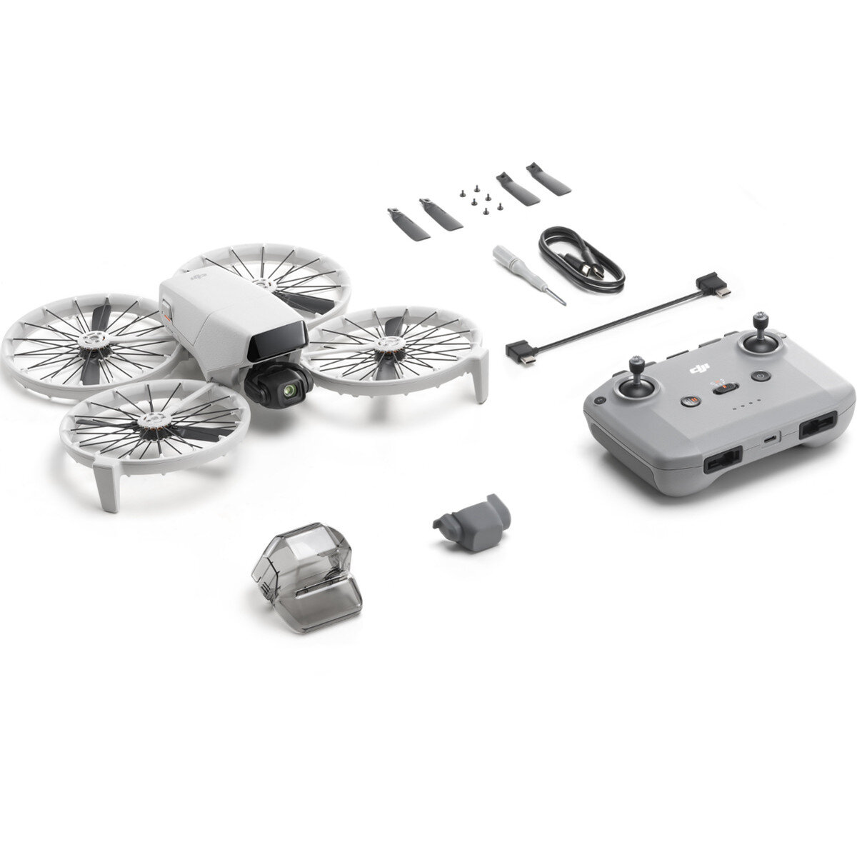
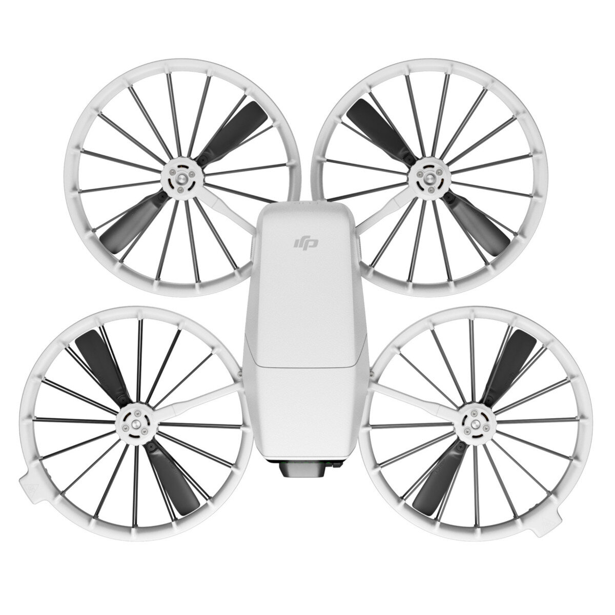
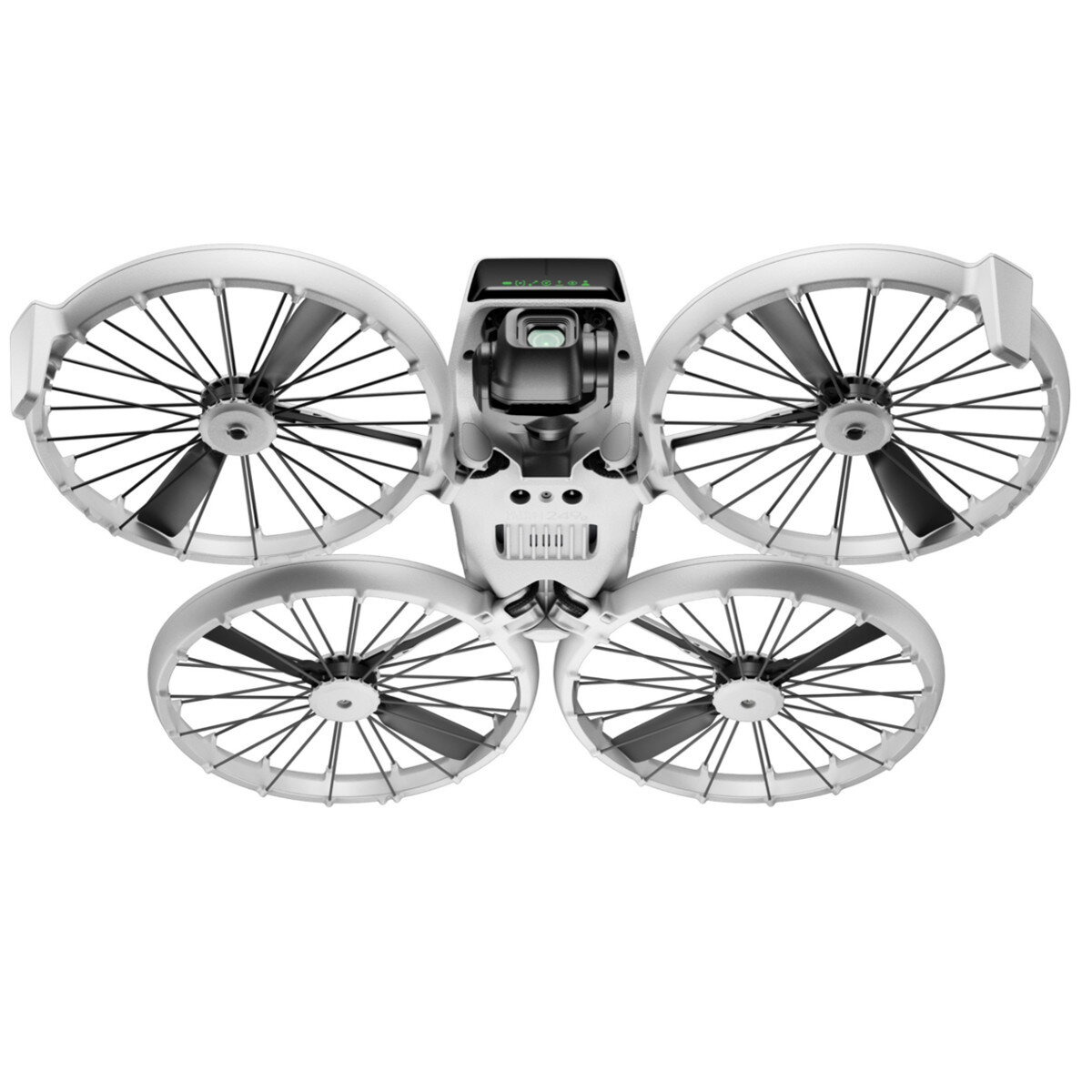
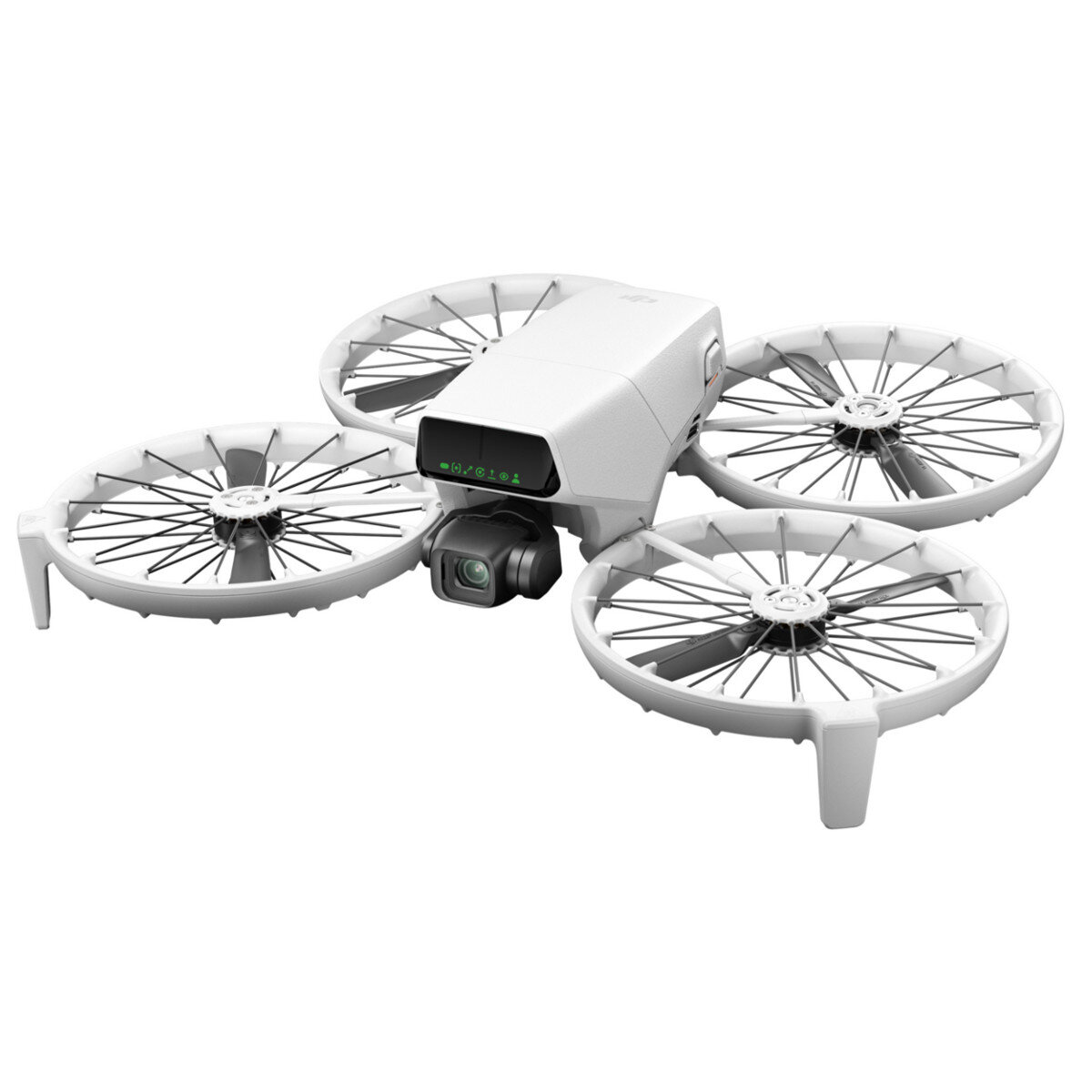
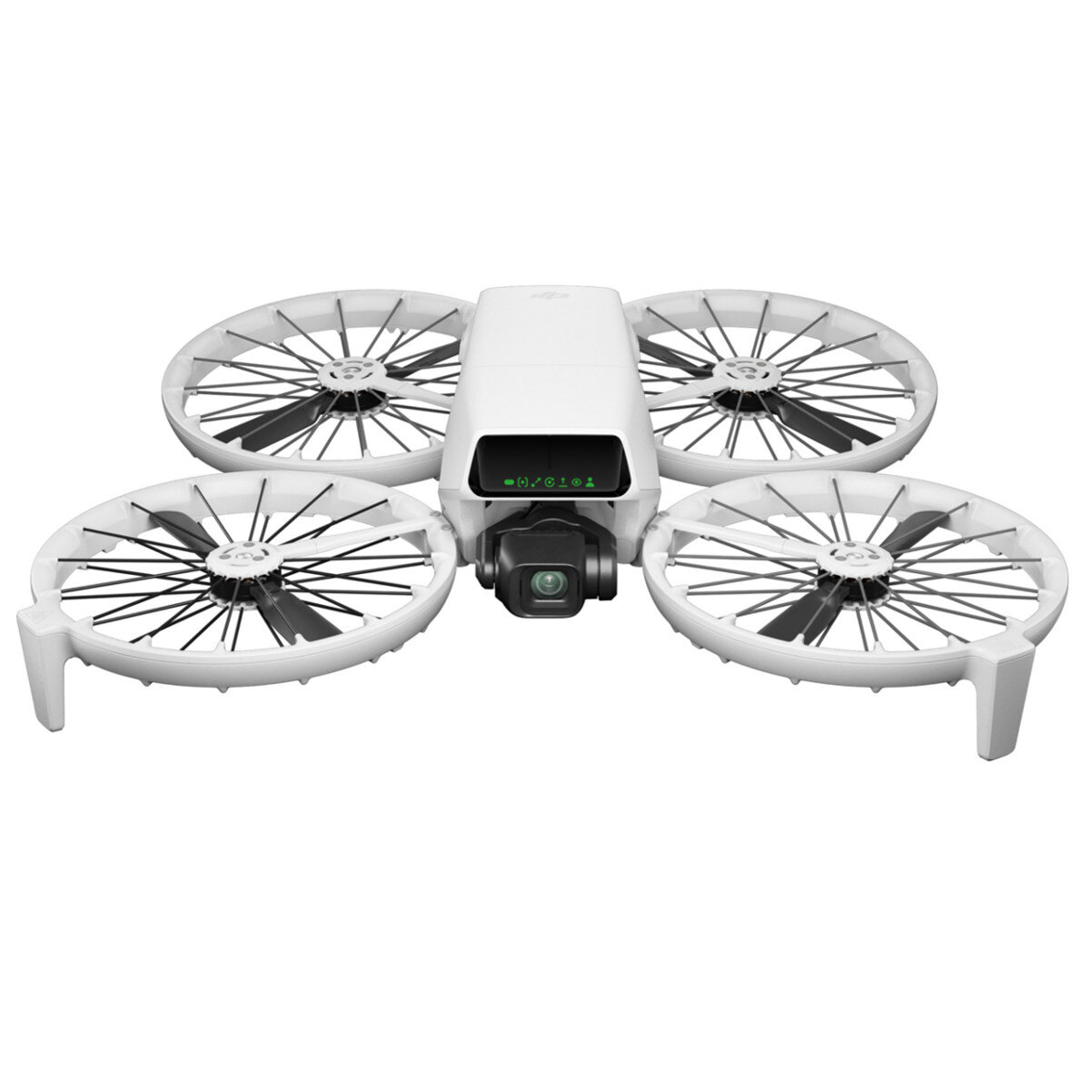
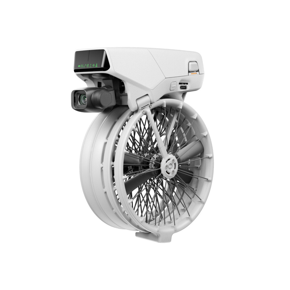
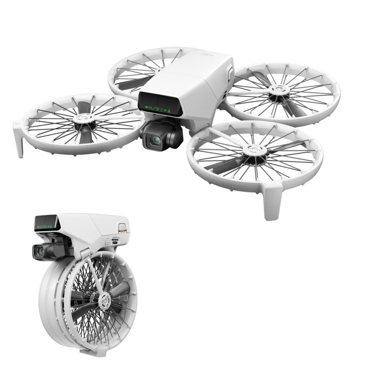
DJI Flip All-in-One Vlog Camera Drone with 1/1.3'' CMOS Sensor 4K 60fps HDR Video AI Subject Tracking 31mins Flight Time Foldable Full-Coverage Props Guard 249g

 Direct purchase from the factory
پرداخت امن

 هدیه رایگان
 سیاست حمل و نقل
 سیاست بازگشت
هدیه رایگان
به Roymall خوش آمدید، فروشگاه هدیه پریمیوم شما. ما از حمایت شما بسیار سپاسگزاریم و به عنوان تشکر، هدیه رایگان با هر خرید ارائه می دهیم. آماده اید تا مجموعه ما را کاوش کنید؟ محصولات ما را مرور کنید، سفارش خود را ثبت کنید و منتظر هدیه رایگان خود همراه با خرید باشید.سیاست حمل و نقل
سفارشات را ظرف 2 روز پردازش می کنیم.زمان تحویل استاندارد 5-7 روز کاری است.زمان تحویل بسته به مقصد ممکن است متفاوت باشد.1. سیاست بازگشت
ما فقط کالاهای خریداری شده از roymall.com را می پذیریم. هدایای رایگان قابل مرجوع نیستند. کالای مرجوعی باید استفاده نشده و در بسته بندی اصلی باشد.مرجوعی را ظرف 3-5 روز کاری پس از دریافت پردازش می کنیم.کالاهای سفارشی قابل مرجوع نیستند.با ما تماس بگیرید: service@roymall.com یا واتساپ: +86193598494712.سیاست بازپرداخت
پس از دریافت و بررسی کالای مرجوعی، مبلغ کامل به شما بازگردانده می شود. هزینه های حمل و نقل قابل بازگشت نیستند.با ما تماس بگیرید: service@roymall.com یا واتساپ: +8619359849471DJI Flip All-in-One Vlog Camera Drone with 1/1.3"" CMOS Sensor 4K 60fps HDR Video AI Subject Tracking 31mins Flight Time Foldable Full-Coverage Props Guard 249g
Specification:
RC Quad | Takeoff weight: | Less than 249 grams Standard weight of aircraft (including DJI Flip Intelligent Flight Battery and microSD card). Product weight may vary due to different material batches and other reasons. Please refer to the actual product; this product is free of registration in some countries or regions. Please check and confirm local laws and regulations. If using the enhanced image transmission module and mounting bracket, the fuselage weight will exceed 249 grams (about 295 grams). Please check, confirm and strictly abide by local laws and regulations before flying. |
Dimensions: | Folded: 136 mm long, 62 mm wide, 165 mm high Unfolded: 233 mm long, 280 mm wide, 79 mm high | |
Maximum ascension speed: | 5 m/s (sport mode) 5 m/s (normal mode) 2 m/s (steady mode) | |
Maximum descent speed: | 5 m/s (sport mode) 5 m/s (normal mode) 1.5 m/s (steady mode) | |
Maximum horizontal flight speed: | At sea level, no wind: 12 m/s* (sport mode) 12 m/s (follow mode) At sea level, 4 m/s downwind, the drone"s flight direction is consistent with the wind direction: 16 m/s* (sport mode) 12 m/s (follow mode) * In the wind tunnel test environment, the aircraft took off at an altitude of 0 meters and rose vertically to 1.5 Meters, measured in sport mode, for reference only. Please pay attention to the prompts on the image transmission interface during actual flight. | |
| Maximum take-off altitude: | 3000 meters In a windless environment, a fully charged aircraft can take off at an altitude of 3000 meters, rise vertically to 500 meters above the ground, and fly in sport mode until the remaining power is 20%. For reference only, please pay attention to the prompts on the image transmission interface during actual flight. |
Maximum Flying Time: | 31 minutes In a windless environment, the camera is in photo mode, and it is measured at an altitude of 20 meters at a constant speed of 6 meters/second until the remaining power is zero. Under different external environments, usage methods, and firmware versions, the results may vary to varying degrees. Please refer to the actual experience. | |
Maximum hovering time: | 28 minutes In a windless environment, the camera is in photo mode, and it is measured at an altitude of 20 meters until the remaining power is zero. Under different external environments, usage methods, and firmware versions, the results may vary to varying degrees. Please refer to the actual experience. | |
Maximum cruising range: | 14 km In a windless environment, the camera is in photo mode, and the battery is measured at an altitude of 20 meters and a constant speed of 9 meters per second until the remaining power is zero. The results may vary to varying degrees under different external environments, usage methods, and firmware versions. Please refer to the actual experience. | |
Maximum wind speed: | 10.7 meters per second (level 5 wind) | |
Working environment temperature: | -10u2103 to 40u2103 | |
Sate1lite navigation system: | GPS + Galileo + BeiDou | |
Hovering accuracy: | Vertical: u00b10.1 meters (when visual positioning works normally) u00b10.5 meters (when sate1lite positioning works normally) Horizontal: u00b10.3 meters (when visual positioning works normally) u00b11.5 meters (when sate1lite positioning works normally) | |
Onboard memory: | 2GB | |
Classification: | EU C0c | |
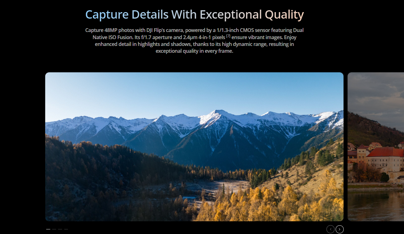
Camera | Image sensor: | 1/1.3-inch image sensor |
Lens: | Field of view (FOV): 82.1u00b0 Equivalent focal length: 24 mm Aperture: f/1.7 Focus: 1m to | |
ISO range: | Video Normal, slow motion: 100 to 6400 (normal color) 100 to 1600 (D-Log M) Photo: 12 megapixels: 100 to 6400 48 megapixels: 100 to 3200 | |
Shutter speed: | 12 megapixels: 1/16000 sec to 2 sec (2.5 sec to 8 sec shutter simulates long exposure) 48 megapixels: 1/8000 sec to 2 sec | |
Maximum photo size: | 48 megapixel photo 8064 u00d7 6048 | |
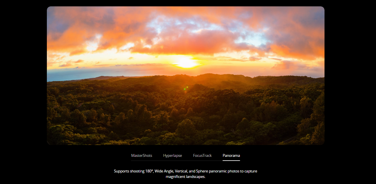
Photo shooting mode and parameters: | Single shot: 12 megapixels and 48 megapixels Multi-shot continuous shooting: 12 megapixels, 3/5/7 frames Auto Exposure Bracketing (AEB): 12 megapixels: 3/5/7 frames @2/3EV step Timer shooting: 12 megapixels: 2/3/5/7/10/15/20/30/60 seconds | |
Image format: | JPEG DNG/RAW | |
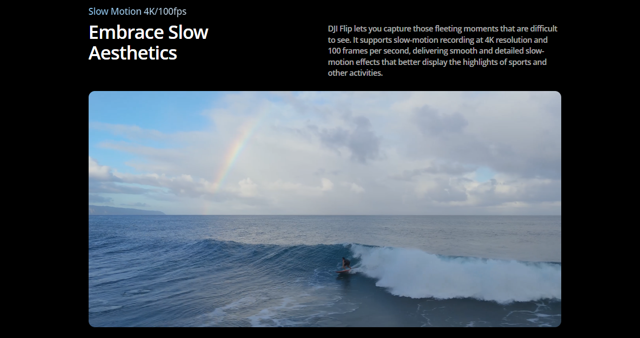
Video resolution: | 4K: 3840 u00d7 2160@24/25/30/48/50/60/100fps FHD: 1920 u00d7 1080@24/25/30/48/50/60/100fps Vertical 2.7K: 1512 u00d7 2688@24/25/30fps Vertical FHD: 1080 u00d7 1920@24/25/30fps | |
Video format: | MP4 | |
Video maximum bitrate: | 150Mbps | |
Supported file system: | exFAT | |
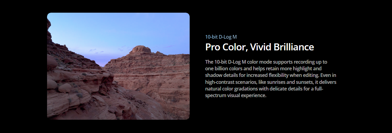
Color mode: | Normal mode D-Log M | |
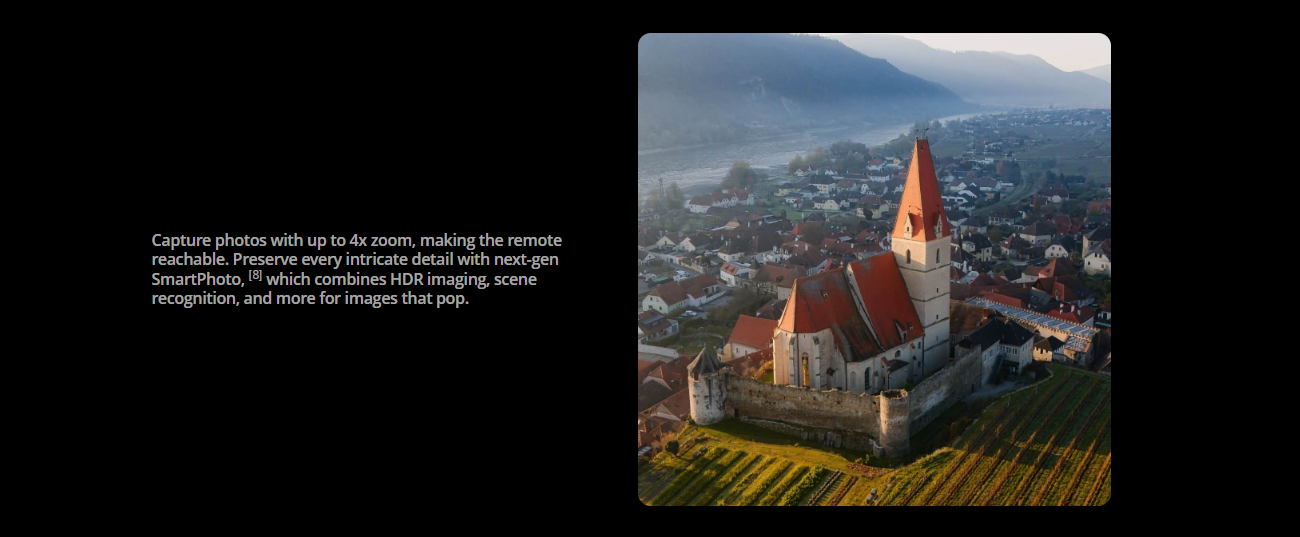
Digital zoom: | 4K: 3x FHD: 4x Vertical 2.7K: 3x Vertical FHD: 4x 12MP photo: 3x | |
Gimbal | Stabilization system: | Three-axis mechanical gimbal (pitch, roll, yaw) |
Structural design range: | Pitch axis: -130u00b0 to 63u00b0 Roll axis: -47u00b0 to 47u00b0 Yaw axis: -30u00b0 to 30u00b0 | |
Controllable rotation range: | Pitch axis: -90u00b0 to 35u00b0 | |
Maximum control speed (pitch): | 100u00b0/s | |
Angular jitter: | u00b10.01u00b0 | |
Perception | Perception system type: | Downward-looking monocular vision with infrared sensor, forward-looking with 3D infrared sensor system |
Forward-looking: | 3D infrared ranging sensor ranging range: 0.3m to 8m (reflectivity greater than 10%) Viewing angle (FOV): horizontal 60u00b0, vertical 60u00b0 | |
Downward-looking: | Ranging range: 0.3m to 8m (reflectivity greater than 10%) Precise hovering range: 0.5m to 10m Viewing angle (FOV): horizontal 60u00b0, vertical 60u00b0 | |
Effective use environment: | Downward: The surface has rich texture, sufficient lighting conditions (greater than 15 lux, normal indoor fluorescent lighting environment), the surface is a diffuse reflective material with a reflectivity greater than 20% (such as cement pavement, etc.) | |
Image transmission | Image transmission solution: | O4 |
Real-time image transmission quality: | Remote controller: up to 1080p/60fps | |
Operating frequency band: | 2.4000 GHz to 2.4835 GHz 5.170 GHz to 5.250 GHz 5.725 GHz to 5.850 GHz The operating frequency bands supported by each country/region and their corresponding available ranges vary. Please refer to local laws and regulations for details. | |
Transmit power (EIRP): | 2.4 GHz: <30 dBm (FCC) <20 dBm (CE/SRRC/MIC) 5.1 GHz: <23 dBm (CE) 5.8 GHz: <33 dBm (FCC) <14 dBm (CE) <30 dBm (SRRC) | |
Maximum signal effective distance (no interference, no obstruction): | FCC: 13 km CE: 8 km SRRC: 8 km MIC: 8 km The above data is measured in an open, unobstructed outdoor environment. It is the maximum communication distance of the image transmission function under each standard. The maximum communication distance in the actual flight scenario is limited by the maximum range of the aircraft. Please pay attention to the return prompt on the image transmission interface during actual flight. | |
Maximum signal effective distance (with interference, without obstruction): | Strong interference (urban center): about 1 to 2.5 kilometers Medium interference (suburban county): about 2.5 to 7 kilometers Micro interference (remote suburbs/seaside): about 7 to 13 kilometers The above data is measured under FCC standards in an unobstructed environment under various typical interference intensity scenarios. The actual flight distance is not guaranteed and is only used as a distance reference for users to fly on their own. | |
Maximum signal effective distance (with interference, with obstruction): | Micro interference, with building obstruction: about 0 kilometers to 0.5 kilometers Micro interference, with bush obstruction: about 0.5 kilometers to 2 kilometers The above data is measured under FCC standards in various typical micro interference intensity and obstructed environments. The actual flight distance is not guaranteed and is only used as a distance reference for users to fly on their own. | |
| Maximum download rate: | DJI O4: DJI RC-N3 remote controller: 10MB/s DJI RC remote controller with screen: 10MB/s Wi-Fi 5: Maximum 30MB/s This data is measured in a low-interference laboratory environment in countries or regions that support 2.4 GHz and 5.8 GHz dual-band. |
Minimum latency: | About 120 milliseconds Depends on the actual shooting environment and mobile device. | |
Antenna: | Four antennas (2.4 GHz: one transmit and two receive; 5.2/5.8 GHz: two transmit and two receive) | |
Wi-Fi | Protocol: | 802.11a/b/g/n/ac |
Operating frequency band: | 2.4000 GHz to 2.4835 GHz 5.7250 GHz to 5.850 GHz The operating frequency bands supported by each country/region and their corresponding available ranges vary. Please refer to local laws and regulations for details. | |
Transmitting power (EIRP): | 2.4 GHz: <20 dBm (FCC/CE/SRRC/MIC) 5.8 GHz: <20 dBm (FCC/SRRC) <14 dBm (CE) | |
E

برای دریافت آخرین اخبار و 15% تخفیف در اولین سفارش خود.
انتخاب ارز

انتخاب زبان
لینک ها:
|